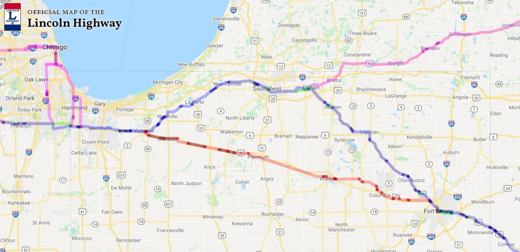
To view an interactive map of the Lincoln Highway, click the photo above. (Lincoln Highway Association).
What is the Lincoln Highway?
The Lincoln Highway was one of the first highway routes to span across the entirety of the United States. Indiana entrepreneur Carl G. Fisher came up with the concept in 1912 and it was finally dedicated on October 31st, 1913, and the history of Indiana would be geared to change forever. The Lincoln Highway ran from Times Square in New York City all the way to Lincoln Park in San Francisco, originally passing through 13 states: New York, New Jersey, Pennsylvania, Ohio, Indiana, Illinois, Iowa, Nebraska, Colorado, Wyoming, Utah, Nevada, and California.
ICI Digs Deep
If you missed the accompanying podcast episode, click below to listen.
Carl G. Fisher
Click on a photo to see its full resolution.
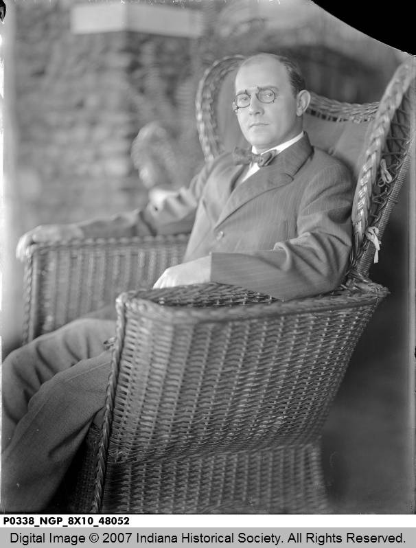
Carl G. Fisher (1874-1939). (Indiana Historical Society/Betzman Collection).
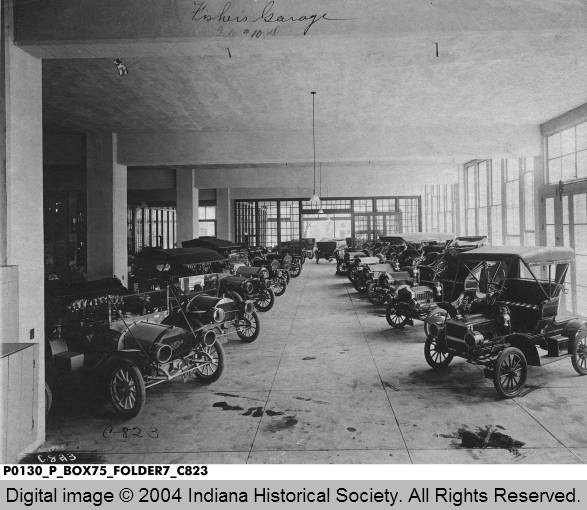
Carl Fisher’s Garage, circa 1910. (Indiana Historical Society/W.H. Bass Photo Co.).
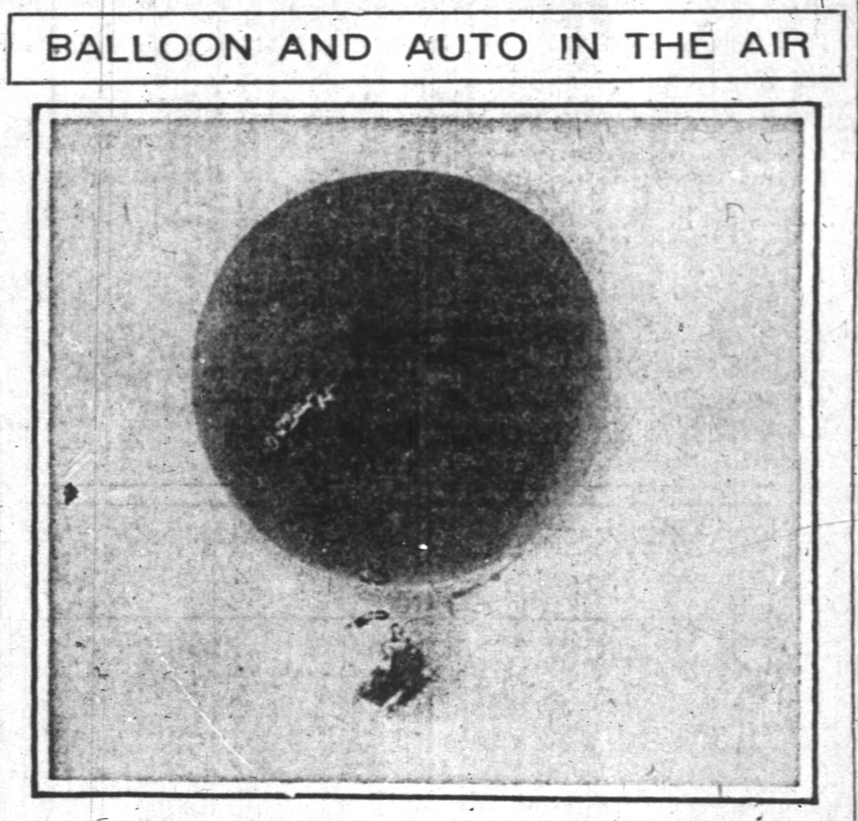
The Indianapolis News, Oct. 31, 1908.
The Indianapolis News, Oct. 31, 1908.
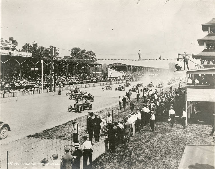
Indianapolis 500, 1919. (Indiana Historical Society/Bass Photo Co Collection).
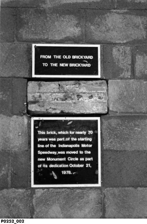
Original Brick from the Indianapolis Motor Speedway Added to Monument Circle, Oct. 21, 1978. (Indiana Historical Society).
Lincoln Highway and the History of Indiana
Click on a photo to see its full resolution.
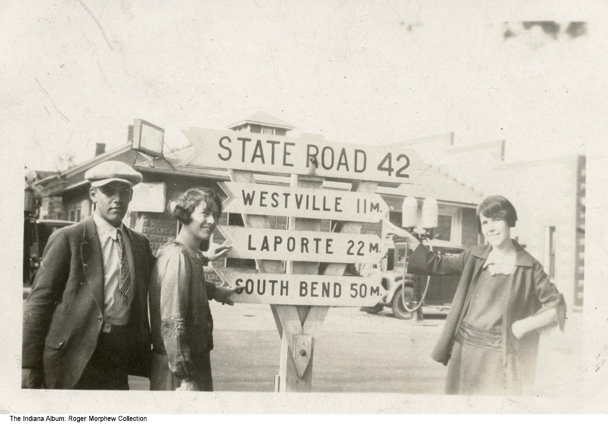
Intersection at East Lincolnway and South Garfield Avenue, Valparaiso, Indiana, circa 1925. (The Indiana Album/Roger Morphew Collection).
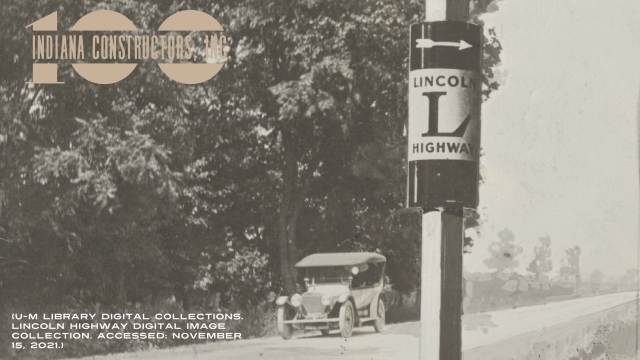
Lincoln Highway Marker, Elkhart, Indiana, circa 1914. (Indiana Historical Society).
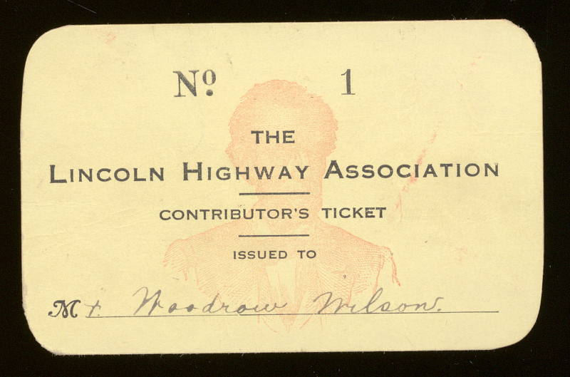
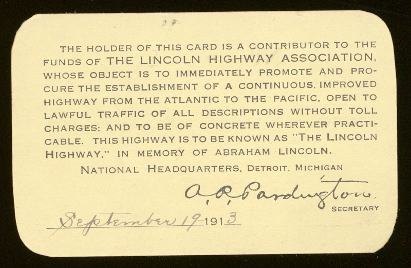
Woodrow Wilson’s Lincoln Highway Association membership card, 1913 (replica). (National Museum of American History).
Woodrow Wilson’s Lincoln Highway Association membership card, 1913 (replica). (National Museum of American History).
1919 Motor Corps Convoy
Click on a photo to see its full resolution and experience the history of Indiana.
Lt. Col. Dwight D. Eisenhower during the 1919 Transcontinental Motor Convoy. (The Dwight D. Eisenhower Presidential Library and Museum).
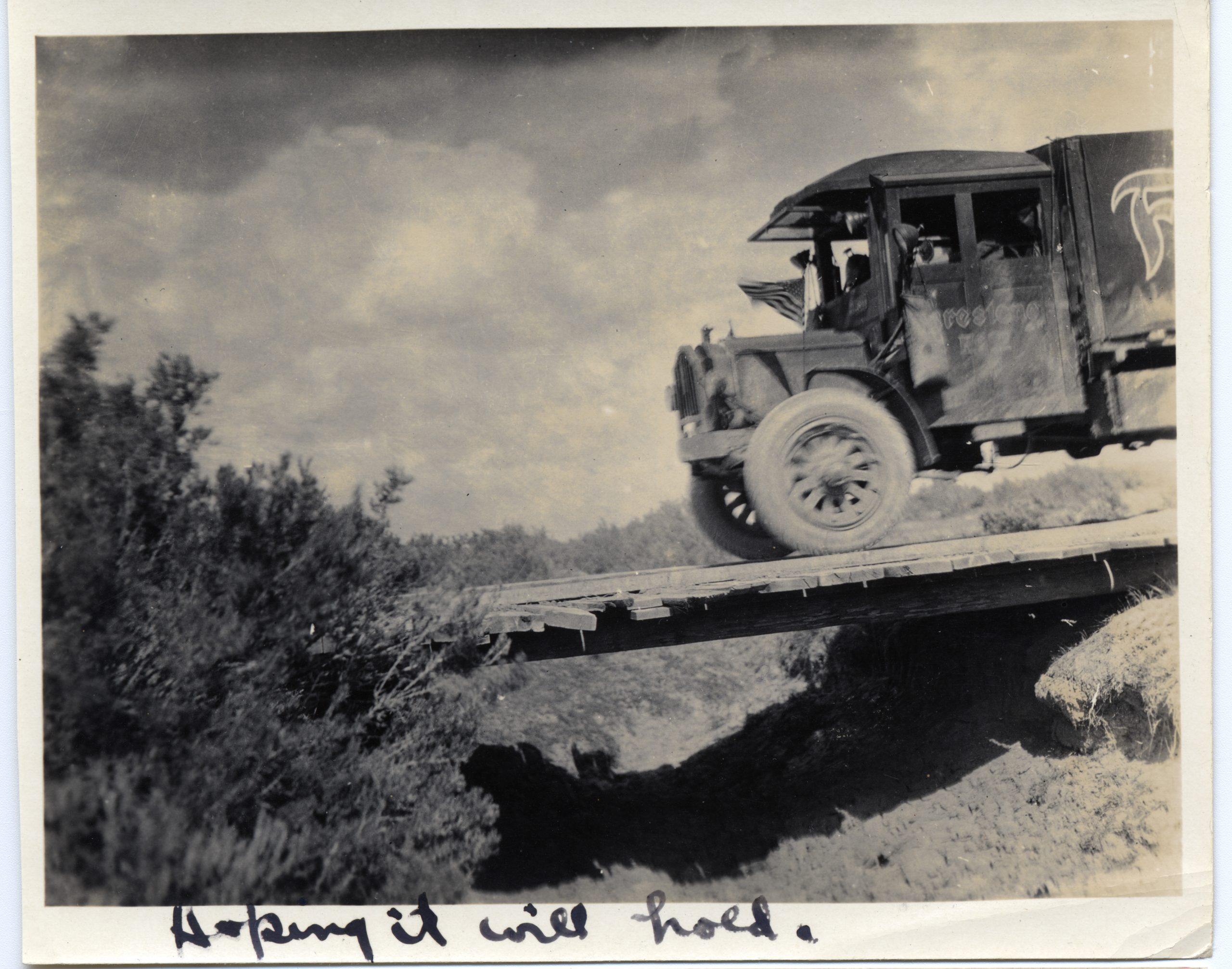
“Hoping it will hold,” 1919 Transcontinental Motor Convoy. (The Dwight D. Eisenhower Presidential Library and Museum).
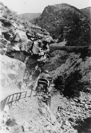
1919 Transcontinental Motor Convoy. (The Dwight D. Eisenhower Presidential Library and Museum).
1919 Transcontinental Motor Convoy. (The Dwight D. Eisenhower Presidential Library and Museum).
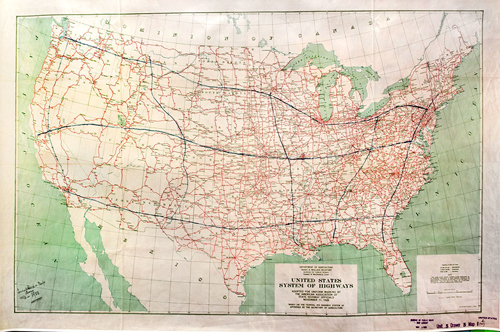
Federal-Aid Highway Act of 1938
Click on a photo to see its full resolution.
The United States System of Highways map with the AASHO-approved U.S. numbered highways as red lines. President Franklin D. Roosevelt had drawn lines in blue showing three east-west transcontinental routes and five north-south routes. (U.S. Department of Transportation/Federal Highway Administration).
Share Your Story of the History of Indiana
As ICI gets ready for its centennial celebration, we are asking residents to provide us with any historical pictures or facts they may have! Roads are an integral part of the history of Indiana, help us celebrate in a big way, and submit your information here!